
REVIEW · CANADA AUDIO TOURS
Cabot Trail: a Smartphone Audio Driving Tour
The best thing about this Cabot Trail tour is that it turns a beautiful drive into a narrated road trip. As you pass Bras d’Or Lake, Cape Smokey, Ingonish, Pleasant Bay, Skyline Trail, Cheticamp, and the Margaree Valley, the app points out what matters and why it matters. You get one tour for the whole vehicle, not one ticket per person.
I like the freedom. You can stop for a waterfall, skip a museum, linger at a lookout, or return to the tour another day. I also like the price: $9 per group of up to 15 people is hard to beat when split among a carload. The main catch is the technology. Download every part on reliable Wi-Fi, and be ready to start some audio clips manually if the GPS or app acts up.
Key points to know before you go
- One $9 purchase covers up to 15 people in one vehicle, making this a strong budget choice for families and friends.
- Download the full tour before leaving, since cell service can be patchy along the Cabot Trail.
- Expect about 4 to 5 hours, but there is no fixed schedule and you can pause whenever you like.
- The narration covers far more than scenery, including Mi’kmaq history, Scottish and Acadian settlement, geology, wildlife, mines, and local culture.
- The GPS may trigger audio automatically, but some users have needed to play stops manually or deal with clips arriving out of order.
- Bring time for short walks, including Lone Shieling, MacIntosh Brook, lookouts, beaches, and suggested waterfalls.
Why an audio guide helps on the Cabot Trail
The Cabot Trail is easy to admire and easy to underappreciate. You can drive past a broad bay, a roadside brook, or a highland lookout without knowing what you are seeing. This tour fills in those blanks while you keep your eyes on the road.
The narrator gives directions to pull-offs, trails, beaches, picnic areas, museums, and food stops. You hear about the rocks beneath the road, the people who settled the area, the animals that live here, and the industries that shaped Cape Breton. Occasional multiple-choice questions add a light touch, especially for families.
This is not a walking tour with a guide beside you. It is a private, self-guided driving companion that plays through your phone and can be connected to a rental car by Bluetooth. You control the pace, the stops, and the volume.
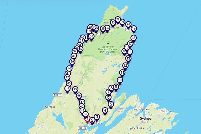
The tour begins at Buckwheat Corner, Nova Scotia, and returns there as its listed endpoint. You can also start at another point, but the direction matters. Several audio cues describe something on your right or left, and going in the opposite direction can make those instructions less useful.
More Self-Guided Driving Tours in Canada
- Icefields Parkway: a Smartphone Audio Driving Tour
★ 4.0 · 118 reviews - Sea to Sky Highway: a Smartphone Audio Driving Tour
★ 4.0 · 32 reviews - The Bay of Fundy Smartphone Audio Driving Tour
★ 4.0 · 28 reviews
Bras d’Or Lake, Bell Island stories, and the road north
Early stops introduce Bras d’Or Lake, a long inland sea with three narrow fingers reaching into northern Cape Breton. It is an important opening because the tour begins to explain how water, roads, settlement, and local work fit together.
You also hear from Alexander Graham Bell through the story of the museum and National Historic Site dedicated to him. The museum is close enough to make a good optional addition if it is open during your visit. The audio gives you a reason to stop rather than treating the museum as just another name on a sign.
The route then turns to the Plaister Mines and the material once taken from the ground. This is the sort of detail that makes a drive more interesting. Instead of seeing only hills and trees, you begin to notice the traces of work and industry around you.
Scottish settlement receives attention too. The Cabot Trail is often sold through its big views, but its character also comes from the people who came here, the traditions they kept, and the communities they built. The tour explains how Scots made a major mark on Cape Breton.
Brooks, wilderness, and useful leg-stretching stops
Goose Cove Brook is one of the prettier water sections on the route. Several brooks join before flowing into the cove, and the tour points out waterfalls along the brook that are accessible by foot.
The North River Wilderness Area protects more than 5,000 hectares of highland plateau and rugged river valley. You are given a sense of the scale of the protected area and suggestions for trails suited to different abilities. This is helpful if you want more than a quick photo stop.
Plaster Provincial Park gets its own explanation as you drive along its edge. The narration gives context about the park and the area around it, then moves toward larger protected areas in the northern part of Nova Scotia.
You will also hear where to stretch your legs, browse shops, or take a break. That practical guidance matters on a long scenic road. The Cabot Trail is not just about reaching the next viewpoint. You need places to pause, use facilities, eat, and let everyone out of the car.
Cape Smokey and Ingonish: big views with a place to pause
A pull-off on the ascent to Cape Smokey gives you a panoramic ocean view before the road reaches the top. Cape Smokey Picnic Park has picnic tables, flush toilets, and scenic lookouts, so it is more useful than a quick roadside photo stop.
The audio then introduces Ingonish, a community made up of five villages at the gates of Cape Breton Highlands National Park. This area brings together fresh and salt water beaches, hiking, golf, wildlife, and coastal scenery.
You hear how Ingonish’s two harbours served the Mi’kmaq for more than 9,000 years and continue to support residents and visitors. That time scale gives the area needed context. The modern resort and recreation scene is only one part of the story.
The stretch around Ingonish is also where the tour gives a broad list of possibilities: trails, whales, golf, goats, camping, beaches, and waterfalls. Do not treat this as a checklist to complete in one pass. Use it to decide what suits your group and what deserves a longer visit.
More Smartphone App Tours in Canada:
- Kelowna: Wine Tasting by E-bike, Smartphone Guide & Lunch
★ 4.8 · 30 reviews - Smartphone Audio Driving Tour between Banff and Calgary
★ 4.0 · 25 reviews - Halifax Churches, Gardens & Graveyards: a Smartphone Audio Walking Tour
★ 4.5 · 25 reviews - Kelowna: E-Bike Rental with In-App Navigation Guide
★ 5.0 · 22 reviews
Cape Breton Highlands National Park and the mountains meeting the sea
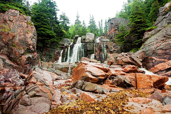
The park is described through its geology and ecology. Glaciers and rivers shaped the highlands, creating an environment with plants and animals found nowhere else in Nova Scotia. The tour also explains that the plateaus form the northern tip of the Appalachian Mountains, which extend from Florida to Newfoundland.
This is a strong part of the narration because it helps you read the scenery. A cliff, lake, forest, or broad valley becomes part of a larger story rather than a series of disconnected views.
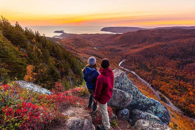
The tour points out lookoffs along the road, including one with a view of the major fault line cutting through the highland plateau. It also suggests stops near French Lake, where a pull-off looks over a highland lake surrounded by boreal forest.
At Lone Shieling, you can take a magical sounding but quite manageable 15-minute walk through old sugar maples to a replica Scottish crofter’s hut. Interpretive panels explain its story. MacIntosh Brook offers another short option, a roughly 30-minute family-friendly walk that follows a brook to a woodland waterfall. Dogs are included in the description of this trail, which is useful if your road trip includes one.
Pleasant Bay, whales, moose, and the famous Skyline view

Pleasant Bay is called the whale-watching capital of Cape Breton. The tour gives you a rundown of activities in this coastal section, including the practical reason to spend time here rather than simply drive through.
A lookoff provides a broad Gulf of St. Lawrence view and a good place to catch your breath. Another viewpoint near the Fishing Cove Trail entrance looks toward mountain headlands sweeping down to the ocean.
Moose receive their own explanation. Cape Breton’s moose have an unusual history, and the tour identifies a popular area where these large animals feed on forest herbs and aquatic plants around a lake. Wildlife is never guaranteed, of course, so treat this as habitat information rather than a promise of a sighting.
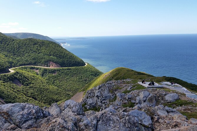
Skyline Trail is one of the signature stops. If you have seen postcard images of the Cabot Trail, they may well have been taken from the end of this trail. The headland cliff gives a dramatic view of the road winding along French Mountain, and the path is described as a well-maintained, easy walk.
Because the tour gives you notice before stops, you have a better chance of deciding in advance if you have time for Skyline. That is one of the app’s most useful jobs. It helps you avoid passing a major stop and realizing it too late.
Acadian settlements and the western side of the park

The route continues into places shaped by Acadian settlement. One trail is described as a walk through history, connected to roughly 30 Acadian families, including refugees from the 1755 expulsion in Nova Scotia.
Le Buttereau, meaning little hill, was once home to seven Acadian families. The narration explains more about those settlers and points to the area’s cultural importance.
The Cheticamp River marks the western entrance to the national park. Nearby are a campground and four trails, including Le Chemin du Buttereau. The river mouth has a broad gravel and sand bar that sweeps from the red bluffs of Buttereau across the tidal estuary. It nearly cuts the river off from the sea, making this a good place to slow down and look carefully.
Cheticamp is introduced as one of the world’s Acadian capitals. It offers whale watching, a museum, restaurants, and a golf course. On Cheticamp Island, Plage St. Pierre provides a sandy beach and campground if you want time beside the water rather than another lookout.
The tour also explains Mi-careme, an Acadian tradition involving masks and celebration. If the Centre de la Mi-careme is open and you have time, you can visit and make your own mask. This is a welcome change from scenery-only commentary.
The Gulf coast, Belle Cote, and the Margaree River
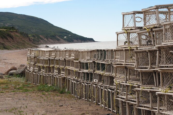
As you travel south, the scenery flattens and opens toward the Gulf of St. Lawrence. The narration explains the Cape Breton Trough, a marine environment beneath these coastal waters.
Belle Cote translates as beautiful coast, and a detour down Belle Cote Beach Road lets you see why. This is a good example of the tour’s value: it does not merely identify a village. It suggests a short route that lets you experience the name for yourself.
Crossing the bridge over Margaree Harbour can be surprising. The estuary is nearly a kilometre wide, so it may look like a lake rather than a river. At East Margaree Crossing, bridges offer views along the valley floor, where you might see someone fishing in waders in the shallows.
The hills here are part of the Appalachian range. The tour also points toward Live Life in Tents River Tours, which offers camping from primitive sites to glamping and guided trips through rapids. If you want an active add-on, this is the sort of local option worth checking in advance.
The Margaree Salmon Museum and nearby Margaree Fish Hatchery give anglers another reason to stop. A picnic park beside the road provides a view of low mountains across the lake, a quiet place for lunch or a short break.
The final stretch includes an old mine in the hills and two unusual churches standing side by side, both with white clapboard and grey spires. The narration explains how the matching churches came to be. Those small local stories are often what make a road trip feel connected to real communities.
How the app works, and how to avoid frustration

The app needs a good mobile or Wi-Fi connection for the initial download. Do this before reaching the trail. Download the map, text, audio, and photo content, then run through the tutorial while you still have a reliable connection.
This advice is not optional. Cell coverage can be weak along the route, and incomplete downloads have caused trouble. A fully downloaded tour should reduce dependence on mobile data, but you should still know how to start a stop manually.
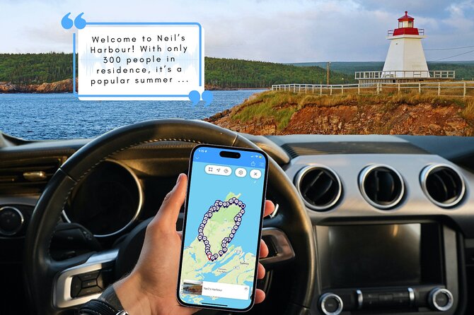
The GPS-triggered system can start narration as you approach a point. It may also work if you begin somewhere other than the official starting point and use Bluetooth with your rental car. Still, audio has sometimes failed to self-advance, played out of order, or required manual starts.
Start the first stop before driving far. It explains the sounds and signals used by the tour and helps you understand how the app behaves. Keep the phone secured and let the passenger handle it. Do not operate the phone while driving.
Is $9 good value for this Cabot Trail tour?
Yes, if you want context and suggestions without paying for a private guide. At $9 per vehicle for as many as 15 people, the cost is tiny for a family or group. Even a couple pays less than many conventional activities.
The value comes from the number of useful suggestions packed into the drive: short walks, waterfalls, viewpoints, beaches, museums, picnic areas, food, wildlife areas, and cultural stops. You can use only part of the tour and still get your money’s worth, especially if it helps you find one stop you would have missed.
The trade-off is that the audio does not replace a detailed park guide or local planning. Some sections spend a lot of time describing trails, and some suggested attractions may be closed or inaccessible depending on the season. One past suggestion for Mary Ann Falls was outdated because the road had been closed to pedestrians and cyclists since 2022, so check current conditions before following any recommendation.
You also need your own vehicle, smartphone or tablet, and time to set up the app. The tour is offered in English only.
Who should buy it?
I would recommend it to families, couples, first-time visitors, and anyone who prefers to explore alone but wants a steady stream of information. It is especially useful for a group that cannot agree on a strict schedule because you can stop, skip, or return to the material whenever you wish.
It also suits people who enjoy small trails and local stories as much as major viewpoints. The mix of geology, Mi’kmaq history, Scottish and Acadian settlement, mines, wildlife, and food gives the drive more substance.
I would hesitate if you dislike app setup, expect perfect automatic playback, or want a live guide who can answer questions. The technical glitches are real, and the safest way to use the tour is to prepare before you leave.
Should you book the Cabot Trail audio tour?
Book it if you already plan to drive the Cabot Trail and want a low-cost guide that helps you notice more. The strongest reasons are the price, the flexible timing, the private format, and the clear suggestions for lookouts and short walks.
Skip it if you will have no reliable Wi-Fi before departure or if you do not want to manage a phone-based tour. For everyone else, download it early, start with the tutorial, keep a passenger in charge of the device, and treat the narration as a helpful road companion rather than an infallible schedule.
Free cancellation is available up to 24 hours before the start time. Cancellations inside 24 hours are not refunded.
FAQ
How much does the Cabot Trail audio tour cost?
The tour costs $9 per group of up to 15 people. One booking covers everyone in the same vehicle.
How long does the tour take?
The estimated duration is 4 to 5 hours. You can take longer because the tour has no fixed time limit.
Do I need cell service during the drive?
No signal or mobile data is required after the tour has been downloaded. You do need a good mobile or Wi-Fi connection for the initial download.
Where does the tour start and end?
The listed starting point is Buckwheat Corner, Nova Scotia, B0E 1B0. The activity ends back at the meeting point.
Can I start the tour at a different stop?
Yes. The tour can be started at any stop, but beginning with the first stop is recommended because it explains how the audio works.
Do I need my own vehicle?
Yes. Transportation is not included, and you use your own vehicle for the drive.
Is the tour available in languages other than English?
No. The tour is offered in English.
Can I use the tour more than once?
Yes. The tour is yours to keep and can be enjoyed again at flexible dates.
What happens if I cancel?
You receive a full refund if you cancel at least 24 hours before the experience start time. Cancellations or changes made less than 24 hours ahead are not accepted or refunded.
Just added around Canada
- Smartphone Audio Driving Tour between Huntsville & Toronto★ 4.5 · 4 reviews
- Halifax Explosion Smartphone Audio Walking Tour★ 4.0 · 3 reviews
- Explore Halifax with 3 Unique Smartphone Audio Walking Tours★ 4.0 · 16 reviews
- Smartphone Audio Driving Tour between Collingwood and Toronto★ 4.5 · 3 reviews
- Self Guided Audio Driving Tour of the North Shore of PEI★ 4.0 · 24 reviews
- Charlottetown Audio Walking Tour★ 5.0 · 7 reviews
- A 7th-Gen Local’s View of Downtown Charlottetown: An Audio Tour★ 4.5 · 27 reviews
- The Sights of Canmore: a Smartphone Audio Walking Tour★ 4.0 · 4 reviews
Canada Audio Tours, compared.


Vancouver Bike or Ebike Rental – Self Guided Map provided
Read our review →
Mont-Tremblant: Treetop Observatory and Self-Guided Walk
Read our review →


Vancouver to Whistler Seaplane Day Trip: Self-Guided Adventure
Read our review →
Ottawa: 4 or 8-Hour Bike Rental with Self-Guided Tour
Read our review →Browse the lists this tour appears in